We will no longer be supporting IE7 and below as a web browser effective June 1st 2020. Click here for more information.

Sign In
Skip Navigation LinksSimcoe County > Departments > Information Technology > Geographical Information Systems - Maps

Geographical Information Systems - Maps

​​​​​​​​​​​​​​​​​​​​​​​​​​​​​​​​​​​County ​​​​​​​​​Interactive Mapping System

View and explore the County of Simcoe using our interactive mapping system. 

  • ​​Interactive Maps
  • Need Help?
    Are you new to our mapping application or want to learn about some new tools or features it has to offer? Please take moment to browse our help document. It should point you in the right direction.

Broadband Mapping


What’s Inside?

Feedback – We're interested in what you have to say!

Please send us any feedback you may have. It helps us learn how our maps are being used and also helps to prioritize improvements to the application. Every comment is read and if an email address is included we will reply promptly to any questions you may have. [ Submit Feedback ]

Other Interactive Maps

War Memorials   |  Historic Sites


Aerial Imagery KML and WMS Links: ​

 *For WMS please right click and copy the link address

This table contains links to aerial imagery dating back to 1954 of Simcoe County. Links are provided in KML and WMS formats, which can be added to compatible applications for viewing.
​Year ​WMSKML
​2022 Imagery
2022 WMS​ imagery link​​
Downlo​ad 2022 imagery .kmz
​2018 Imagery
2018 WMS​ imagery link​​
Downlo​ad 2018 imagery .kmz
​2016 Imagery

2016 WMS​ imagery link
Downlo​ad 2016 imagery .kmz
​2013 Imagery2013 WMS imagery link Download 2013 imagery .kmz
​2012 Imagery2012 WMS imagery link Download 2012 imagery .kmz
​2008 Imagery2008 WMS imagery link Download 2008 imagery .kmz
​2002 Imagery​2002 WMS imagery link Download  2002 imagery .kmz
​1997 Imagery​
19​97 WMS imagery link Download 1997 imagery .kmz​
​1989 Imagery
​1989 WMS imagery link
​​Download 1989 imagery .kmz
​1978 Imagery
1978 WMS imagery link
​​Download 1978 imagery .kmz
​1954 Imagery​1954 WMS imagery link Download 1954 imagery .kmz

Find us on ArcGIS.com 
Use our maps with ArcGIS for AutoCAD


About Geographical Information Systems (GIS)About Geographical Information Systems (GIS)<p>​​
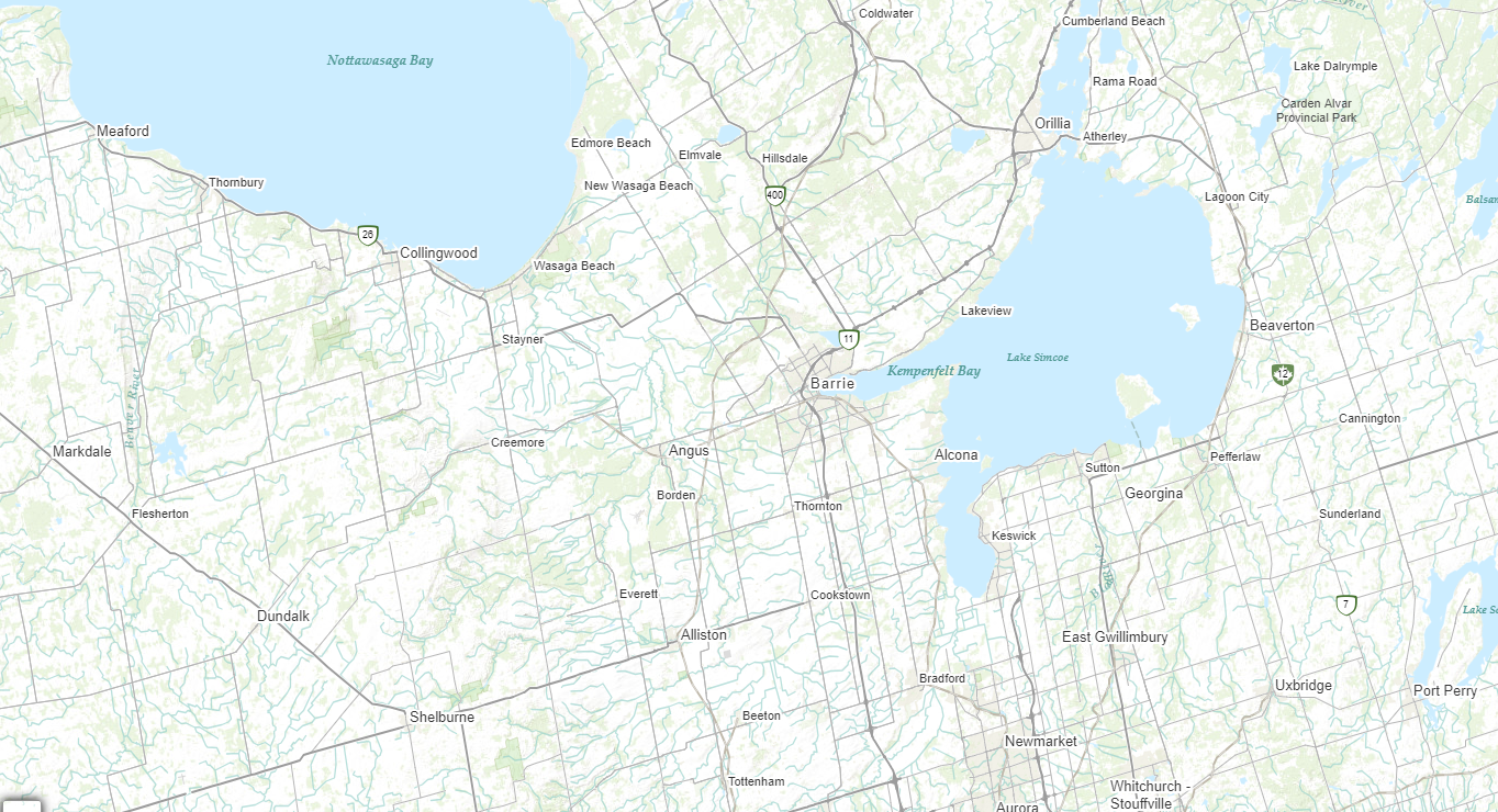
A map is the best and most efficient way to describe physical positions and relationships. For many organizations that use maps as part of their everyday decision making it is important that maps be automated and linked to other informational databases. The integrated product that has developed from linking maps with data is commonly referred to as a Geographic Information System (GIS). <br><br>Our mandate is to develop, implement, operate, administer and promote the use of spatial information technologies within the County of Simcoe, its municipalities and its larger network of partners.​<br></p>
Purchase Paper MapsPurchase Paper Maps<p><div style="text-align:left;margin-right:0px;">Paper maps can be purchased from:</div></p><ul dir="ltr" style="text-align:left;margin-right:0px;"><li><div style="margin-right:0px;">County of Simcoe</div></li><li><div style="margin-right:0px;">Customer Service Centre</div></li><li><div style="margin-right:0px;">1110 Hwy 26, Midhurst, Ontario</div></li></ul><div style="text-align:left;margin-right:0px;">We are open between the hours of 8:30 am & 4:30 pm from Monday to Friday. </div><div style="text-align:left;margin-right:0px;">You can also order maps by contacting the Customer Service Centre:</div><ul><li><div style="margin-left:0px;">Local Phone: (705) 735-6901</div></li><li><div style="margin-left:0px;">Toll Free: 1(800) 263-3199</div></li><li><div>Email: <a href="mailto:info@simcoe.ca">info@simcoe.ca</a></div></li></ul><p><div style="text-align:left;margin-right:0px;">Customer Service accepts cash, Interac, VISA or Mastercard as methods of payment when purchases are made in person at the County's Administration Centre.</div><div style="text-align:left;margin-right:0px;"> </div><div style="text-align:left;margin-right:0px;">Review the GIS Product Catalogue (7.3 Mb PDF)</div></p>
Interactive Trail MapsInteractive Trail Maps<p> <strong>Loop Trails</strong><br></p><ul><li><a href="http://maps.simcoe.ca/Trails/?TRAIL=GrantsWoodsLoopTrail" target="_blank">Grants Wood Loop Trail</a></li><li><a href="http://maps.simcoe.ca/Trails/?TRAIL=NottawasagaBluffsLoopTrail" target="_blank">Nottawasaga Bluffs Loop Trail</a></li><li> <a href="https://maps.simcoe.ca/trails/?TRAIL=ScanlonCreekConservationAreaLoopTrail" target="_blank">Scanlon Creek CA Loop Trail</a></li><li><a href="https://maps.simcoe.ca/trails/?TRAIL=ScoutValleyloopTrail" target="_blank">Scout Valley Loop Trail</a></li><li><a href="https://maps.simcoe.ca/trails/?TRAIL=TiffinCentreConservationAreaLoopTrail" target="_blank">Tiffin Centre CA Loop Trail</a></li><li> <a href="http://maps.simcoe.ca/Trails/?TRAIL=TinyMarshLoopTrail" target="_blank">Tiny Marsh Loop Trail</a></li><li> <a href="https://maps.simcoe.ca/trails/?TRAIL=TottenhamConservationAreaLoopTrail" target="_blank">Tottenham CA Loop Trail</a></li></ul> <strong>Linear Trails</strong><br> <ul><li> <a href="https://maps.simcoe.ca/trails/?TRAIL=ClearviewCollingwoodTrainTrail" target="_blank">Collingwood Clearview Train Trail</a></li><li> <a href="https://maps.simcoe.ca/trails/?TRAIL=CollingwoodWaterfrontTrail" target="_blank">Collingwood Waterfront Trail</a></li><li><a href="https://maps.simcoe.ca/trails/?TRAIL=GeorgianTrail" target="_blank">Georgian Trail</a></li><li><a href="https://maps.simcoe.ca/trails/?TRAIL=HicklingTrail" target="_blank">Hickling Trail</a></li><li> <a href="http://maps.simcoe.ca/Trails/?TRAIL=InnisfilBeachParkTrail" target="_blank">Innisfil Beach Park Trail</a></li><li><a href="http://maps.simcoe.ca/Trails/?TRAIL=MidlandRotaryWaterfrontTrail" target="_blank">Midland Rotary Waterfront Trail</a></li><li> <a href="https://maps.simcoe.ca/trails/?TRAIL=NorthSimcoeRailTrail" target="_blank">North Simcoe Rail Trail</a></li><li> <a href="http://maps.simcoe.ca/Trails/?TRAIL=OrilliaMillenniumTrail" target="_blank">Orillia Millenium Trail</a></li><li><a href="https://maps.simcoe.ca/trails/?TRAIL=OroMedonteRailTrail" target="_blank">Oro-Medonte Rail Trail</a></li><li> <a href="https://maps.simcoe.ca/trails/?TRAIL=PenetanguisheneTrail" target="_blank">Penetanguishene Trail</a></li><li> <a href="http://maps.simcoe.ca/Trails/?TRAIL=RamaraTrail" target="_blank">Ramara Trail</a></li><li> <a href="https://maps.simcoe.ca/trails/?TRAIL=RouteChamplainTrail" target="_blank">Route Champlain Trail</a></li><li> <a href="http://maps.simcoe.ca/Trails/?TRAIL=TayShoreTrail" target="_blank">Tay Shore Trail</a></li><li> <a href="https://maps.simcoe.ca/trails/?TRAIL=ThorntonCookstownTransCanadaTrail" target="_blank">Thornton-Cookstown Trans Canada Trail</a></li><li> <a href="http://maps.simcoe.ca/Trails/?TRAIL=TinyTrail" target="_blank">Tiny Trail</a></li><li> <a href="http://maps.simcoe.ca/Trails/?TRAIL=UhthoffTrail" target="_blank">Uhthoff Trail</a></li><li> <a href="https://maps.simcoe.ca/trails/?TRAIL=WasagaBeachShoreLaneTrail" target="_blank">Wasaga Beach Shore Lane Trail</a></li></ul>

Map Gallery - Downloadable Maps

Below are some common map products available for download. The maps are in Adobe Acrobat PDF format and vary in size. Users will require a fast Internet connection and Adobe Acrobat Reader to view the maps. These maps are provided as-is with no assurances as to accuracy, completeness or appropriateness for intended use. The maps are not a legal survey and are protected by copyright. View our full terms of use here.


Map BooksMap Books<ul dir="ltr"><li><div style="text-align:left;">​<a href="/InformationTechnology/Documents/Adjala-Tosorontio%20Map%20Book.pdf" target="_blank">Township of Adjala-Tosorontio</a> (3.5 MB PDF)<img class="ms-rtePosition-2 ms-rteImage-2" alt="Township of Adjala-Tosorontio Map Book" src="/InformationTechnology/PublishingImages/mapbooks1.png" style="margin:5px 15px;width:150px;height:195px;" /></div></li><li><div style="text-align:left;"><a href="/InformationTechnology/Documents/Bradford%20West%20Gwillimbury%20Map%20Book.pdf" target="_blank">Town of Bradford West Gwillimbury</a> (3.5 MB PDF)</div></li><li><div style="text-align:left;"><a href="/InformationTechnology/Documents/Clearview%20Map%20Book.pdf" target="_blank">Township of Clearview</a> (3.3 MB PDF)</div></li><li><div style="text-align:left;"><a href="/InformationTechnology/Documents/Collingwood%20Map%20Book.pdf" target="_blank">Town of Collingwood</a> (1.9 MB PDF)</div></li><li><div style="text-align:left;"><a href="/InformationTechnology/Documents/Essa%20Map%20Book.pdf" target="_blank">Township of Essa</a> (2.8 MB PDF)</div></li><li><div style="text-align:left;"><a href="/InformationTechnology/Documents/Innisfil%20Map%20Book.pdf" target="_blank">Town of Innisfil</a> (3.7 MB PDF)</div></li><li><div style="text-align:left;"><a href="/InformationTechnology/Documents/Midland%20Map%20Book.pdf" target="_blank">Town of Midland</a> (2.2 MB PDF)</div></li><li><div style="text-align:left;"><a href="/InformationTechnology/Documents/New%20Tecumseth%20Map%20Book.pdf" target="_blank">Town of New Tecumseth</a>​​​​ (2.4 MB PDF)</div></li><li><div style="text-align:left;"><a href="/InformationTechnology/Documents/Oro-Medonte%20Map%20Book.pdf" target="_blank">Township of Oro-Medonte</a> (5.7 MB PDF)</div></li><li><div style="text-align:left;"><a href="/InformationTechnology/Documents/Penetanguishene%20Map%20Book.pdf" target="_blank">Town of Penetanguishene</a> (2.0 MB PDF)</div></li><li style="text-align:left;"><div><a href="/InformationTechnology/Documents/Ramara%20Map%20Book.pdf" target="_blank">Township of Ramara</a> (4.3 MB PDF)<img class="ms-rteImage-0 ms-rtePosition-2" alt="Map of Adjala-Tosorontio" src="/InformationTechnology/PublishingImages/Mapbooks.png" style="margin:5px 15px;width:150px;height:195px;" /></div></li><li><div style="text-align:left;"><a href="/InformationTechnology/Documents/Severn%20Map%20Book.pdf" target="_blank">Township of Severn</a> (7.1 MB PDF)</div></li><li><div style="text-align:left;"><a href="/InformationTechnology/Documents/Springwater%20Map%20Book.pdf" target="_blank">Township of Springwater</a> (4.0 MB PDF)</div></li><li><div style="text-align:left;"><a href="/InformationTechnology/Documents/Tay%20Map%20Book.pdf" target="_blank">Township of Tay</a> (3.3 MB PDF)</div></li><li><div style="text-align:left;"><a href="/InformationTechnology/Documents/Tiny%20Map%20Book.pdf" target="_blank">Township of Tiny</a> (4.4 MB PDF)</div></li><li><div style="text-align:left;"><a href="/InformationTechnology/Documents/Wasaga%20Beach%20Map%20Book.pdf" target="_blank">Town of Wasaga Beach</a> (2.8 MB PDF)</div></li></ul>
Municipal Base MapsMunicipal Base Maps​<br><table border="0" cellspacing="0" cellpadding="0" style="width:100%;height:1807px;text-align:center;"><tbody><tr><td width="50%"><div style="text-align:center;"><img alt="County Base Map" src="/InformationTechnology/PublishingImages/CountyBaseMap.png" style="margin:5px;" /> </div><div> </div><div style="text-align:center;"><a href="/InformationTechnology/Documents/Simcoe%20County%20Base%20Map.pdf" target="_blank">County Base​​​ Map</a> <span style="text-align:center;line-height:24.64px;">(PDF</span><span style="text-align:center;line-height:24.64px;">)</span></div><div style="text-align:center;"> </div></td><td style="width:317px;text-align:center;"><div><img alt="County Forest and Other Recreation Areas Map" src="/InformationTechnology/PublishingImages/County%20Forest%20and%20Other%20Recreation%20Areas%20Map.png" style="margin:5px;" /><br> <a href="/InformationTechnology/Documents/Simcoe%20County%20Forest%20and%20Other%20Recreation%20Areas%20Map.pdf" target="_blank" style="line-height:1.54;font-size:1em;">County Forest &Other Recreation Areas Map</a> <span style="text-align:center;line-height:24.64px;">(PDF</span><span style="text-align:center;line-height:24.64px;">)</span>​</div></td></tr><tr style="text-align:center;"><td width="50%"><br></td><td style="width:317px;"></td></tr><tr style="text-align:center;"><td width="50%"><div><img alt="Township of Adjala-Tosorontio Map" src="/InformationTechnology/PublishingImages/Township%20of%20Adjala-Tosorontio%20Map.png" style="margin:5px;" /> </div><div><a href="/InformationTechnology/Documents/Adjala-Tosorontio.pdf" target="_blank">Township of Adjala-Tosorontio Map</a> <span style="text-align:center;line-height:24.64px;">(PDF</span><span style="text-align:center;line-height:24.64px;">)</span></div></td><td style="width:317px;"><div><img alt="Town of Bradford West Gwillimbury Map" src="/InformationTechnology/PublishingImages/Town%20of%20Bradford%20West%20Gwillimbury%20Map.png" style="margin:5px;" /><br><a href="/InformationTechnology/Documents/BradfordWestGwillimbury.pdf" target="_blank" style="line-height:1.54;font-size:1em;">Town of Bradford West Gwillimbury Map</a> <span style="text-align:center;line-height:24.64px;">(PDF</span><span style="text-align:center;line-height:24.64px;">)</span><br></div></td></tr><tr style="text-align:center;"><td width="50%"> </td><td style="width:317px;"> </td></tr><tr style="text-align:center;"><td width="50%"><div><img alt="Township of Clearview Map" src="/InformationTechnology/PublishingImages/Township%20of%20Clearview%20Map.png" style="margin:5px;" /><br> <a href="/InformationTechnology/Documents/Clearview.pdf" target="_blank" style="line-height:1.54;font-size:1em;">Township of Clearview Map</a> <span style="text-align:center;line-height:24.64px;">(PDF</span><span style="text-align:center;line-height:24.64px;">)</span></div></td><td style="width:317px;"><div><img alt="Town of Collingwood Map" src="/InformationTechnology/PublishingImages/Town%20of%20Collingwood%20Map.png" style="margin:5px;" /><br> <a href="/InformationTechnology/Documents/Collingwood.pdf" target="_blank" style="line-height:1.54;font-size:1em;">Town of Collingwood Map</a> <span style="text-align:center;line-height:24.64px;">(PDF</span><span style="text-align:center;line-height:24.64px;">)</span></div></td></tr><tr style="text-align:center;"><td width="50%"> </td><td style="width:317px;"> </td></tr><tr style="text-align:center;"><td width="50%"><div><img alt="Town of Essa Map" src="/InformationTechnology/PublishingImages/Township%20of%20Essa%20Map.png" style="margin:5px;" /><br> <a href="/InformationTechnology/Documents/Essa.pdf" target="_blank" style="line-height:1.54;font-size:1em;">Township of Essa Map</a> <span style="text-align:center;line-height:24.64px;">(PDF</span><span style="text-align:center;line-height:24.64px;">)</span></div></td><td style="width:317px;"><div><img alt="Town of Innisfil Map" src="/InformationTechnology/PublishingImages/Town%20of%20Innisfil%20Map.png" style="margin:5px;" /><br><a href="/InformationTechnology/Documents/Innisfil.pdf" target="_blank" style="line-height:1.54;font-size:1em;">Town of Innisfil Map</a> <span style="text-align:center;line-height:24.64px;">(PDF</span><span style="text-align:center;line-height:24.64px;">)</span><br></div></td></tr><tr style="text-align:center;"><td width="50%"> </td><td style="width:317px;"><br></td></tr><tr style="text-align:center;"><td width="50%"><div><img alt="Town of Midland Map" src="/InformationTechnology/PublishingImages/Town%20of%20Midland%20Map.png" style="margin:5px;" /><br> </div><div><a href="/InformationTechnology/Documents/Midland.pdf" target="_blank">Town of Midland Map</a> <span style="text-align:center;line-height:24.64px;">(PDF</span><span style="text-align:center;line-height:24.64px;">)</span></div></td><td style="width:317px;"><div><img alt="Town of New Tecumseth" src="/InformationTechnology/PublishingImages/Town%20of%20New%20Tecumseth.png" style="margin:5px;" /><br> <a href="/InformationTechnology/Documents/NewTecumseth.pdf" target="_blank" style="line-height:1.54;font-size:1em;">Town of New Tecumseth Map</a> <span style="text-align:center;line-height:24.64px;">(PDF</span><span style="text-align:center;line-height:24.64px;">)</span></div></td></tr><tr style="text-align:center;"><td width="50%"> </td><td style="width:317px;"> </td></tr><tr style="text-align:center;"><td width="50%"><div><img alt="Township of Oro-Medonte Map" src="/InformationTechnology/PublishingImages/Township%20of%20Oro-Medonte%20Map.png" style="margin:5px;" /> </div><div><a href="/InformationTechnology/Documents/Oro-Medonte.pdf" target="_blank">Township of Oro-Medonte Map</a> (PDF)</div></td><td style="width:317px;"><div><img alt="Town of Penetanguishene Map" src="/InformationTechnology/PublishingImages/Town%20of%20Penetanguishene%20Map%20.png" style="margin:5px;" /><br> <a href="/InformationTechnology/Documents/Penetanguishene.pdf" target="_blank" style="line-height:1.54;font-size:1em;">Town of Penetanguishene Map</a> <span style="text-align:center;line-height:24.64px;">(PDF</span><span style="text-align:center;line-height:24.64px;">)</span></div></td></tr><tr style="text-align:center;"><td width="50%"> </td><td style="width:317px;"> </td></tr><tr style="text-align:center;"><td width="50%"><div><img alt="Township of Ramara Map" src="/InformationTechnology/PublishingImages/Township%20of%20Ramara%20Map.png" style="margin:5px;" /> </div><div><a href="/InformationTechnology/Documents/Ramara.pdf" target="_blank">Township of Ramara Map</a> <span style="text-align:center;line-height:24.64px;">(PDF</span><span style="text-align:center;line-height:24.64px;">)</span></div></td><td style="width:317px;"><div><img alt="Township of Severn Map" src="/InformationTechnology/PublishingImages/Township%20of%20Severn%20Map.png" style="margin:5px;" /><br><a href="/InformationTechnology/Documents/Severn.pdf" target="_blank" style="line-height:1.54;font-size:1em;">Township of Severn Map</a> <span style="text-align:center;line-height:24.64px;">(PDF</span><span style="text-align:center;line-height:24.64px;">)</span><br></div></td></tr><tr style="text-align:center;"><td width="50%"> </td><td style="width:317px;"> </td></tr><tr style="text-align:center;"><td width="50%"><div><img alt="Township of Springwater Map" src="/InformationTechnology/PublishingImages/Township%20of%20Springwater%20Map.png" style="margin:5px;" /><br><a href="/InformationTechnology/Documents/Springwater.pdf" target="_blank" style="line-height:1.54;font-size:1em;">Township of Springwater Map</a> <span style="text-align:center;line-height:24.64px;">(PDF</span><span style="text-align:center;line-height:24.64px;">)</span><br></div></td><td style="width:317px;"><div><img alt="Township of Tay Map" src="/InformationTechnology/PublishingImages/Township%20of%20Tay%20Map.png" style="margin:5px;" /><br><a href="/InformationTechnology/Documents/Tay.pdf" target="_blank" style="line-height:1.54;font-size:1em;">Township of Tay Map</a> <span style="text-align:center;line-height:24.64px;">(PDF</span><span style="text-align:center;line-height:24.64px;">)</span><br></div></td></tr><tr style="text-align:center;"><td width="50%"> </td><td style="width:317px;"> </td></tr><tr style="text-align:center;"><td width="50%"><div><img alt="Township of Tiny Map" src="/InformationTechnology/PublishingImages/Township%20of%20Tiny%20Map.png" style="margin:5px;" />​<br> <a href="/InformationTechnology/Documents/Tiny.pdf" target="_blank" style="line-height:1.54;font-size:1em;">Township of Tiny Map</a> <span style="text-align:center;line-height:24.64px;">(PDF</span><span style="text-align:center;line-height:24.64px;">)</span></div><div><br></div></td><td style="width:317px;"><div><img alt="Town of Wasage Beach Map" src="/InformationTechnology/PublishingImages/Town%20of%20Wasaga%20Beach%20Map.png" style="margin:5px;" /><br> <a href="/InformationTechnology/Documents/WasagaBeach.pdf" target="_blank" style="line-height:1.54;font-size:1em;">Town of Wasaga Beach Map</a> <span style="text-align:center;line-height:24.64px;">(PDF</span><span style="text-align:center;line-height:24.64px;">)</span></div><div><br></div></td></tr></tbody></table>

Official Plan

Please visit our Planning Department page for additional information and approved schedules.​
​​